Australia, India deepen undersea domain awareness partnership
Mandeep Singh
As foreign submarines and survey vessels probe deeper into the Indo-Pacific’s most critical maritime corridors, Australia and India are shifting their defense partnership below the waterline. A three-year joint science and technology project, underway since 2025, pairs India’s Naval Physical and Oceanographic Laboratory (NPOL) with Australia’s Defence Science and Technology Group (DSTG) to co-develop Towed Array Target Motion Analysis algorithms, technology designed to sharpen the detection and tracking of silent submarines and autonomous underwater vehicles.
The initiative reflects a broader transition to what analysts call underwater domain awareness, countering China’s expanding subsurface footprint while protecting the sea lanes and undersea infrastructure upon which Australia and India depend.
“China’s growing deployment of nuclear and conventional submarines, alongside ocean-mapping vessels in the Indian and Pacific Oceans, poses a direct security challenge to New Delhi and Canberra,” retired Indian Army Col. Anil Bhat told FORUM.
The challenge has been reinforced by a string of incidents:
- A People’s Liberation Army Navy (PLAN) destroyer approached a Royal Australian Navy frigate near Japan in November 2023 and operated its hull-mounted sonar in a dangerous manner injuring an Australian diver working to remove fishing nets from the frigate’s propeller.
- A Chinese vessel shadowed an Indian missile test in 2024.
- Taiwan’s Coast Guard detained a Chinese-crewed cargo ship in February 2025 and accused it of deliberately cutting an undersea internet cable.
Moreover, reports indicate a coordinated Chinese effort to map ocean floors across the Pacific and Indian oceans.
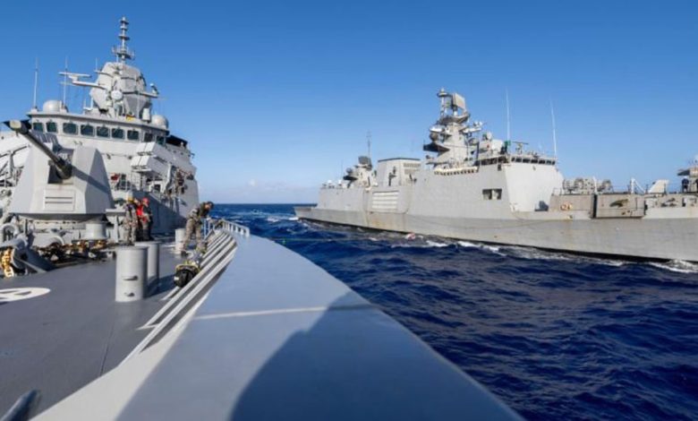
The NPOL-DSTG project sits within a wider institutional buildup. Under the Australia and India Comprehensive Strategic Partnership, exercises such as AUSINDEX increasingly emphasize anti-submarine tracking, while new agreements on shipping data, intelligence exchange and submarine search-and-rescue cooperation have formalized the navies’ underwater collaboration. India has also operationalized its Information Fusion Centre-Indian Ocean Region in Gurugram, linking tracking data directly with Australian maritime headquarters, and the two air forces now use bases at the Cocos Keeling Islands and the Andaman and Nicobar Islands to extend long-range anti-submarine patrol loops, according to Australia’s Lowy Institute.
That cooperation extends into other minilateral formats, frameworks that sit between bilateral ties and large multilateral bodies such as ASEAN. The Quad, which also includes the U.S. and Japan, functions as the primary vehicle for stitching together space-based sensors, aerial patrols and seabed tracking into a shared maritime picture, while Exercise Malabar rehearses anti-submarine warfare among the partners.
Undersea cable security has become a parallel priority. The Australia-India Cables Dialogue focuses on mapping vulnerabilities across the region’s undersea fiber-optic network, infrastructure that carries a majority of the world’s data and financial transactions. Officials in both countries have discussed alternative routing through trusted regional suppliers to reduce dependence on chokepoints such as the Malacca Strait.
— STORY CONTINUES BELOW —
Join the discussion
How could your nation benefit from joining Allies and Partners to boost underwater domain awareness?
The NPOL-DSTG partnership is boosted by the complementary strengths of each side. “This union bridges the gap between high-end technological innovation and real-world deployment, creating a combined force that improves regional maritime security better than either nation could achieve alone,” Bhat said. Australia contributes advanced acoustic-signal research and algorithm development through institutions such as Geoscience Australia, while India supplies expanding industrial capacity and a persistent operational presence across the Indian Ocean, including its Sandhayak-class hydrographic survey fleet and P-8I patrol aircraft, which map thermal and salinity profiles across the Bay of Bengal and North Indian Ocean. Australia focuses its mapping effort on the deep-water trenches of the Southern Ocean, the Timor Sea and the Southwest Pacific.
The strategic logic, Bhat said, extends beyond detection. “Knowing sensors watch the water removes the surprise factor for rival warships,” he said. Persistent monitoring raises the cost of aggressive undersea activity even before any confrontation occurs.
Mandeep Singh is a FORUM contributor reporting from New Delhi, India.